Walking Trails
The trails in I’On don’t just give you a workout. They refresh your soul with gorgeous marsh views, romantic bridges, and exquisite architecture where no two houses are the same or even the same size!
The complete trail map is below, followed by maps with details for each trail, listed in order from easiest (1/2 mile) to most difficult (2 miles). Time and calories burned for each walk are, of course, estimates!
I’On Trail Map
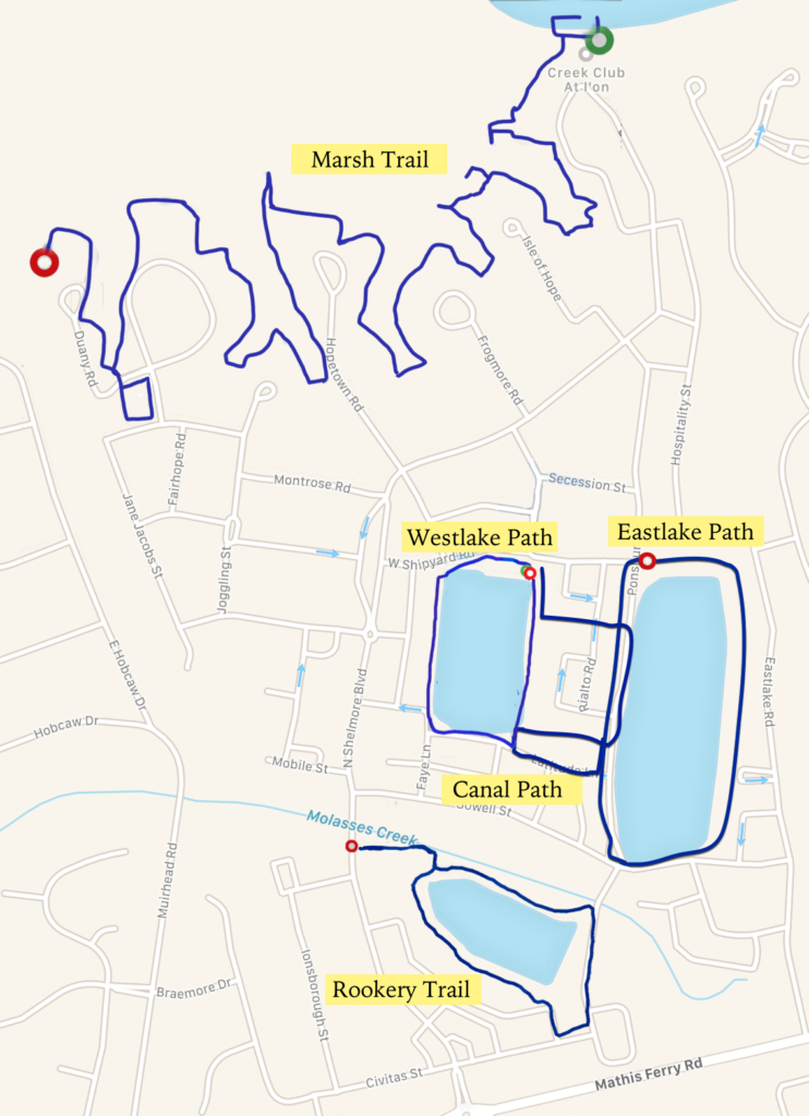
Westlake Path
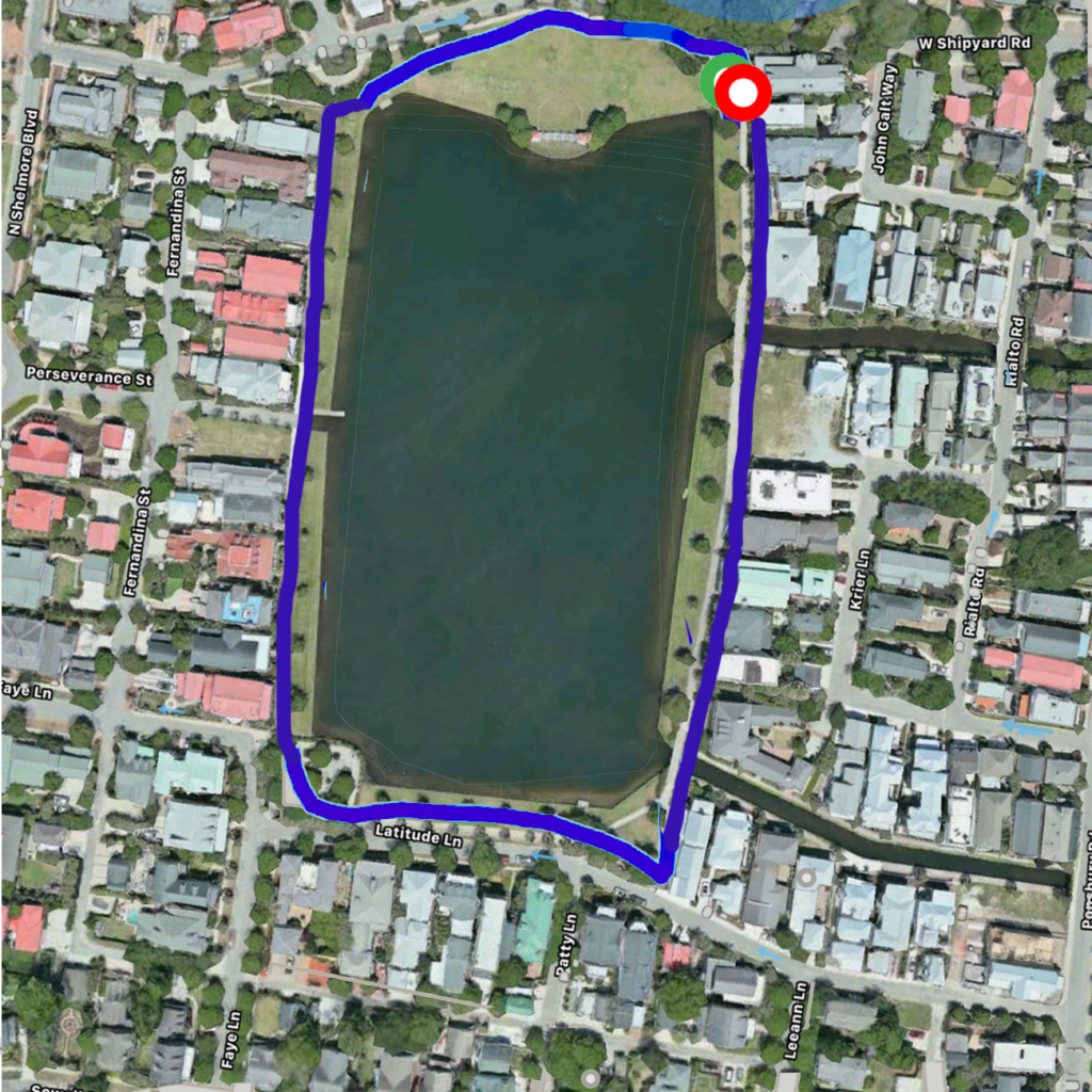
The Westlake Path begins and ends at the intersection of W Shipyard and Moultrieville Roads.
| Distance | Time | Steps | Calories |
| 0.44 mile | 8:16 | 898 | 37 |
I’On Rookery Trail
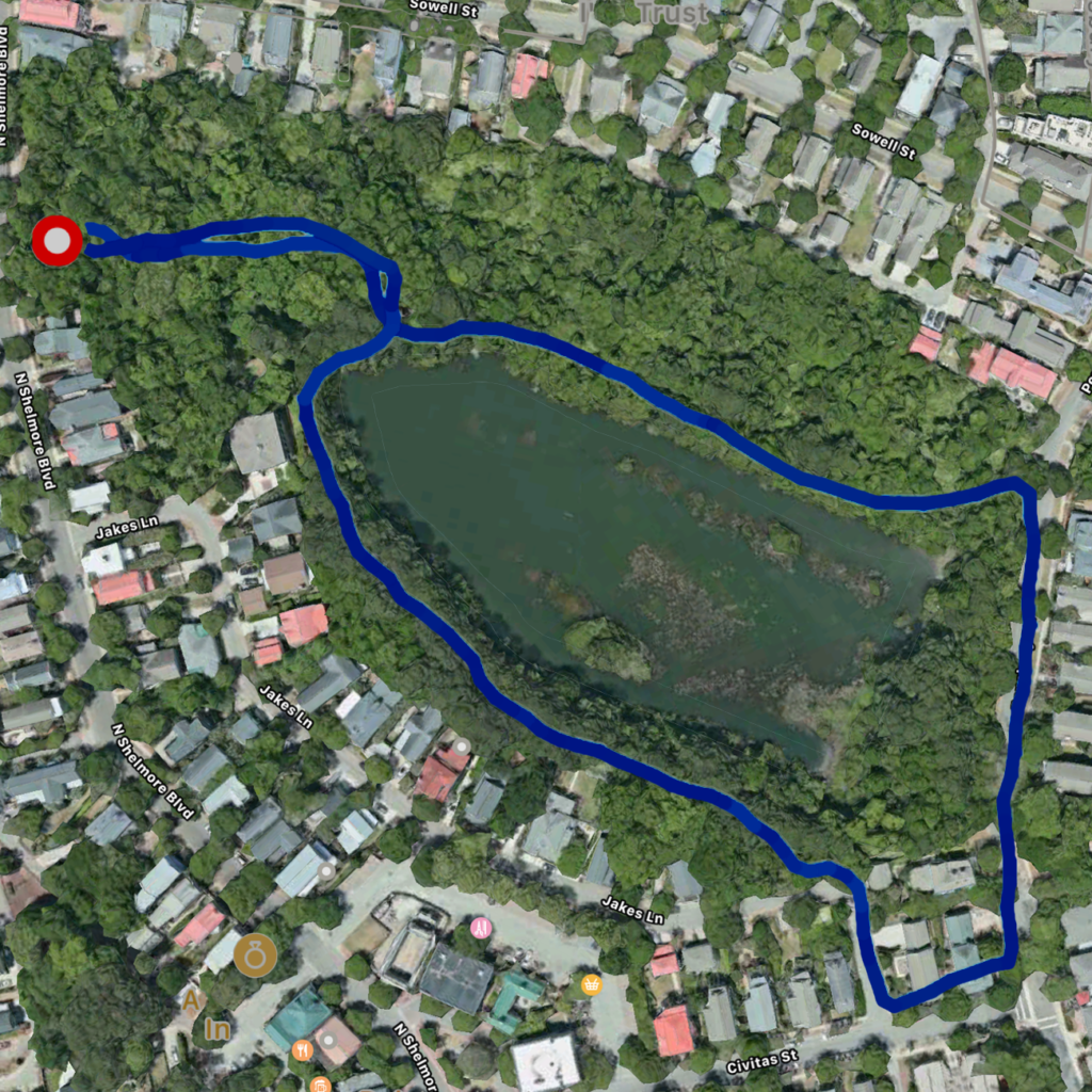
The Rookery has entrances on N Shelmore Blvd, Jakes Lane, Ponsbury Road and the alley behind Sowell Street opposite Patty Lane.
| Distance | Time | Steps | Calories |
| 0.62 mile | 13:07 | 1,323 | 54 |
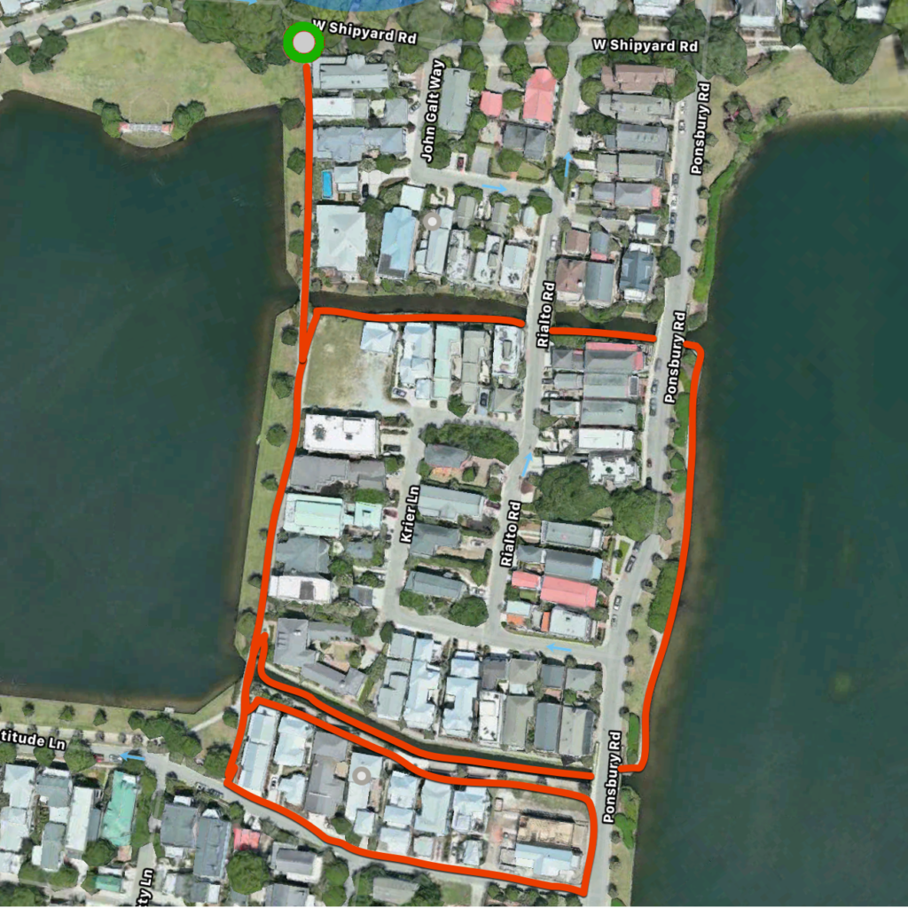
Eastlake Path
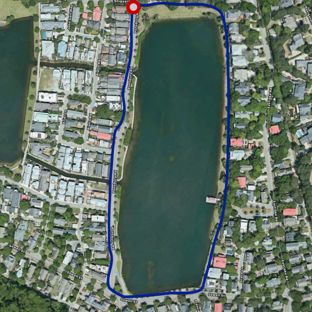
The Eastlake Path begins and ends at the intersection of W Shipyard and Ponsbury Roads.
| Distance | Time | Steps | Calories |
| 0.66 mile | 13:16 | 1,368 | 56 |
Canal Walk
Like the Westlake Path, the Canal Walk also starts and ends at the intersection of W Shipyard and Moultrieville Roads.
| Distance | Time | Steps | Calories |
| 0.69 mile | 13:00 | 1,396 | 63 |
Marsh Trail
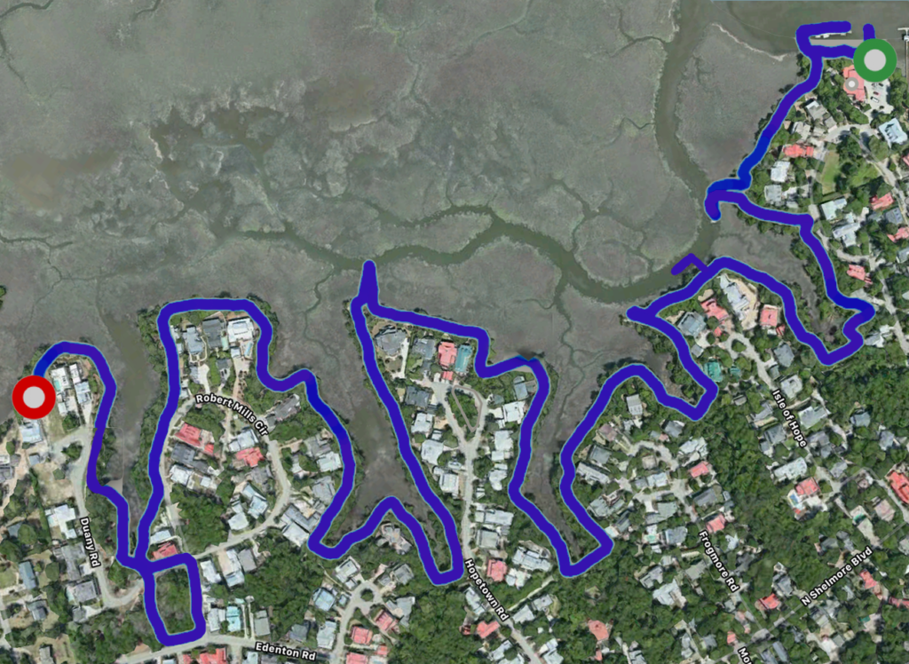
The Marsh Trail starts at the Creek Club and offers views of the marsh looking towards Hobcaw Creek and the Wando River. Enjoy sights of beautiful architecture, wildlife, wooden bridges, and community docks. There are trailheads at all of the streets along the way, so you can start your walk at many different points.
| Distance | Time | Steps | Calories |
| 2.13 miles | 41:39 | 4,643 | 181 |